The U Street Corridor and Shaw
For roughly fifty years, the blocks around U Street were the commercial, musical and intellectual center of Black Washington. Segregation built the corridor by closing everything else, and it produced a district of theaters, offices, halls, churches and storefronts owned and used by people who were shut out of downtown. That concentration is why the area still carries the name Black Broadway, and why so much of what happened here is documented at national scale.
The corridor runs east and west a few blocks north of the older core of Shaw, and the two names overlap in ways nobody agrees on — one more instance of the boundary problem described in the neighborhood guide. Shaw takes its name from a junior high school named for a Union colonel who commanded a Black regiment; U Street takes its name from the grid, which assigns it a letter and nothing else.
What Black Broadway actually was
The description is often taken as purely musical, which undersells it. The corridor held professional offices, banks, insurance and fraternal organizations, a hospital, newspapers, funeral homes, and a university at the top of the hill whose faculty and students used the street daily. Commerce and scholarship shared the same three-story buildings — retail on the ground floor, offices above.
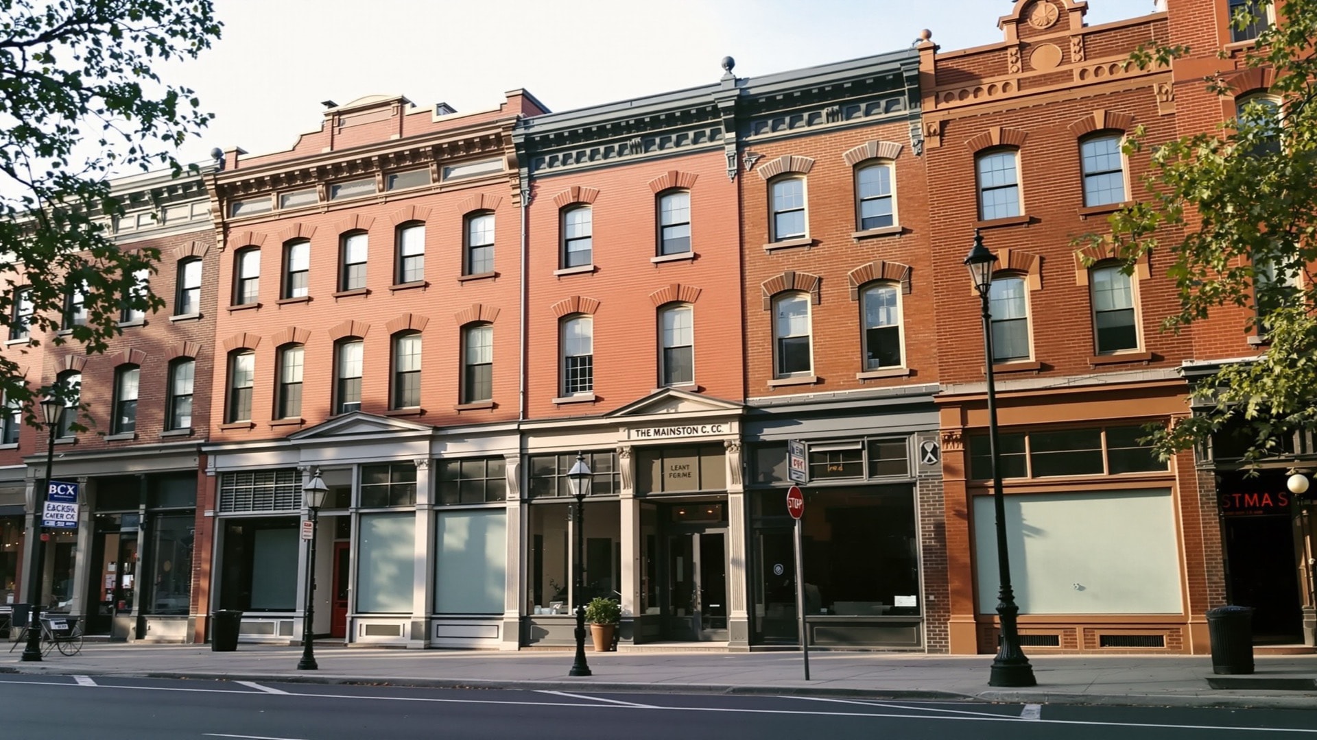
The physical form was ordinary Washington commercial building of its period: pressed brick and terracotta, two and three stories, continuous street walls, large upper-floor windows. What was extraordinary was the ownership pattern and the density of institutions, not the architecture.
The theaters and the music economy
Two large theaters anchored the corridor, one opened in 1910 and built specifically for Black audiences at a time when downtown houses excluded them, and a second opened in 1922. Around them sat a dense economy of smaller rooms, halls and social clubs, which is the part that made the corridor a working circuit rather than a pair of venues. Touring acts played here because the audience was here, and local musicians could make a living without leaving the neighborhood.
Duke Ellington was born in Washington in 1899 and grew up in this part of the city. He heard and played on this circuit as a teenager before leaving for New York in the 1920s, which is the standard and well-documented outline of his Washington years. The corridor's later musical significance, including the emergence of go-go in the 1970s, is covered in go-go and the sound of Washington.
The institutional layer
Three federal sites in and around the corridor preserve the non-commercial half of the story. The Carter G. Woodson Home National Historic Site is the rowhouse where the historian lived and worked; he founded the Association for the Study of Negro Life and History in 1915 and established the observance that became Black History Month. A short distance away, the Mary McLeod Bethune Council House was the headquarters of the National Council of Negro Women and Bethune's Washington home.
At the eastern end of the corridor stands the African American Civil War Memorial, dedicated in 1998, commemorating the roughly 209,000 men who served in the United States Colored Troops. Their names are inscribed on the surrounding wall. All three are administered by the National Park Service, which means the institutional history of the corridor is now, in part, federal property — an odd but durable form of preservation in a district where almost everything else changed hands.
1968 and the long disinvestment
After the assassination of Martin Luther King Jr. in April 1968, unrest broke out along several of the District's Black commercial corridors, this one among them. Hundreds of buildings were damaged or destroyed over several days, federal troops were deployed, and a great deal of the corridor's ground-floor commerce never reopened.
What followed mattered more than the fire. Insurance became difficult, lending withdrew, and property that burned was cleared rather than rebuilt. Vacant lots on prominent corners stayed vacant for twenty-five and thirty years. The buildings that survived stayed standing but lost their tenants gradually, which is why so many upper floors here are original and so many ground floors are not.
The Metro years
Green Line construction ran through the corridor during the 1980s, and the station beneath U Street opened in 1991. The work was cut-and-cover: the street was opened, decked, and worked from above for years at a stretch. Businesses that had survived 1968 and two decades of disinvestment did not survive the construction, and the corridor reached its lowest commercial point roughly when the station was finished. The broader system is described in reading the Metro map.
Reinvestment, and the displacement question
From the late 1990s the direction reversed. The station made the corridor accessible; the vacant lots made large-scale infill unusually easy, because assembling a site did not require buying out existing occupants; and construction filled in steadily through the 2000s and 2010s at six stories, the practical envelope for this street.
The displacement that came with it is not in dispute and should not be softened. The District's population was about 71 percent Black in 1970 and fell below half by the early 2010s, and Shaw and the corridor were among the places where that shift was most concentrated. Both things are true at once: the reinvestment repaired a physically damaged district that public and private capital had abandoned for thirty years, and it did so on terms that moved a great many of the people who had stayed through the abandonment. Neither the celebration nor the elegy describes it accurately on its own.
What survives, and how to read it
Look up. The most reliable evidence is above the ground floor, where original brick, terracotta detail, window rhythm and cornice lines from roughly 1900 to 1925 usually remain even where the storefront below has been replaced two or three times.
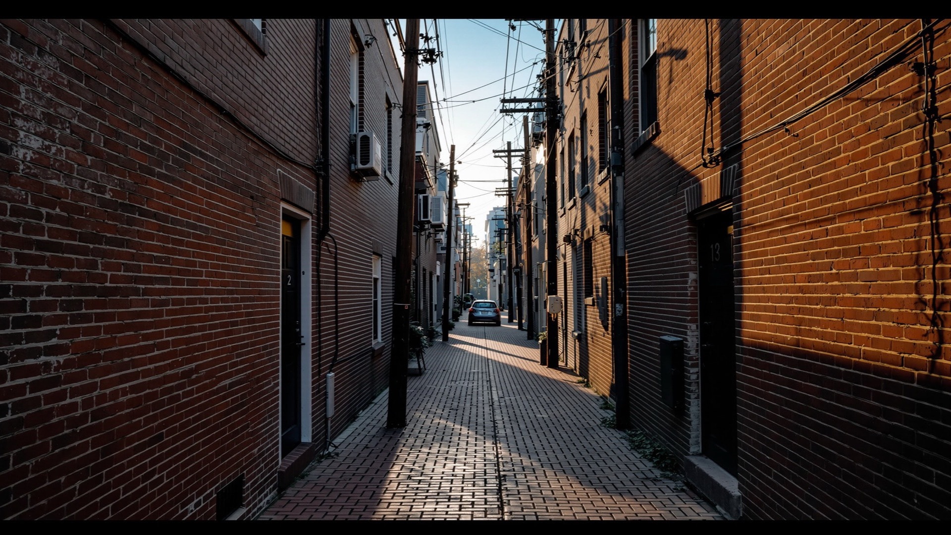
Then look for the breaks. A modern six-story building in a row of three-story fronts is almost always a lot that burned in 1968 or was cleared afterward, and the shift in scale traces the damage more accurately than most maps. Behind the main streets, the narrow interior alleys still carry small dwellings, the second and largely invisible layer of the historic neighborhood.
Finally, look at the institutions. Churches, fraternal and social halls, and the three federal sites are the buildings least likely to have been converted, and together they sketch the shape of the district as it worked. For the rest of the guide, see all guides.