Why Washington Is a Low City: The Height Act
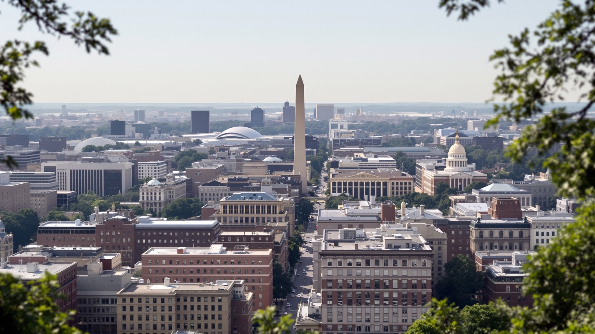
Washington has no skyline in the ordinary American sense. Seen from a bridge or a rooftop, the city reads as a plateau of masonry at a nearly uniform height, broken only by an obelisk, a dome, and a few church towers on high ground. This is not an accident of demand, and it is not a preservation ordinance. It is a federal statute, and it has governed the shape of the city for more than a century.
1899 and 1910
The immediate trigger was a fourteen-story apartment house completed in 1894 that rose about 164 feet, well above anything around it and well above what the city's fire equipment could reach. Congress responded in 1899 with the first general limit on building heights in the District. That statute was replaced by the Height of Buildings Act of 1910, which remains the governing law, amended in detail but not in principle.
The key jurisdictional fact is that the Act is federal. The District does not control it; Congress does. Local zoning sits underneath it and is frequently stricter, so in much of the city the Act is not actually the binding constraint — but downtown, it is.
How the rule works
The 1910 Act does not set one number. It ties maximum height to the width of the street a building faces, plus 20 feet. A building on a wide avenue may therefore be taller than one a block away on a narrow street, and a corner building's envelope is set by the street it fronts.
Above that formula sit ceilings. The general commercial maximum is around 130 feet; residential streets are held lower; and a narrow exception along one stretch of Pennsylvania Avenue permits somewhat more. Spires, towers and domes are treated separately from occupied floor area, which is why several structures in the city legally exceed the limit for occupied space. The National Capital Planning Commission is the federal body that reviews development in and around the capital and has studied the Act's effects in detail.
The myth about the Capitol
The most persistent claim about Washington is that no building may be taller than the Capitol. This has never been true, and the Capitol appears nowhere in the mechanism. The rule is about street width, fire safety and, later, civic character.
Two facts settle it. The Capitol dome rises roughly 288 feet above its base — well above the 130-foot commercial ceiling, so a limit set at the Capitol's height would be far more permissive than the actual law. And the Washington Monument, at 555 feet, was completed in 1884, fifteen years before the first height act, so it both predates the rule and exceeds it by a factor of four. Neither the Architect of the Capitol nor the height statute has ever linked the two.
What the rule actually produced
A height cap in a city with strong demand does not reduce building; it redirects it. Four consequences are visible on the ground.
- Buildings fill their envelopes. When the ceiling is low and land is expensive, developers build to the property line and to the maximum height, producing very large floorplates organized around interior light wells and courtyards. Downtown Washington has some of the deepest commercial floorplates in the country.
- Cornice lines are uniform. Whole blocks arrive at the same height because they all hit the same constraint, which gives central Washington its characteristic flat top edge and makes the street feel like a room.
- The sky is wide and the monuments read. Long views work here in a way they do not in most American downtowns, and the monumental core stays legible from a distance — which was, increasingly, the point.
- Value moves outward. Office and residential density that could not be built downtown was built instead across the river and beyond the District line, where clusters of towers begin abruptly at the jurisdictional boundary. The tax base followed.
The argument about changing it
The Act is revisited every decade or so, most recently in a study prepared for Congress in 2013 by the federal planning commission together with the D.C. Office of Planning. The two bodies did not reach the same conclusion about how far to go, and Congress did not act.
The case for relaxing it is straightforward. Housing is expensive, the region is growing, and an artificial ceiling on floor area near transit raises rents and pushes households outward into longer commutes. Proponents note that the monumental core could be protected on its own terms, with a separate and stricter rule, while allowing more height in outlying commercial districts that no view from the Mall touches.
The case against is not merely sentimental. The horizontal city is a deliberate civic choice and a public good that cannot be recovered once traded away; the legibility of the monuments depends on it; and critics argue the supply gains would be modest, since most parcels in the District are nowhere near their permitted height and the binding constraint there is local zoning and neighborhood politics, not the federal cap. There is also a distributional objection: relaxing the limit would capitalize largely into the land values of a small number of already valuable downtown parcels rather than into lower rents.
Both sides are arguing about real effects. What is not in dispute is that the decision belongs to Congress, which is itself a piece of the District's unusual political position, discussed in taxation without representation.
Seeing it
The effect is invisible at street level and obvious from anywhere with elevation. From a bridge over the Potomac or the Anacostia, or from an upper-floor terrace downtown, the city resolves into a flat mass with three or four things standing above it: the obelisk, the dome, a cathedral tower on the highest ground to the northwest, and one or two exempt spires. Across the water, the towers start immediately and rise three times as high, which is the clearest available illustration of what the Act does and where the demand went.
The same flatness is why the river and park edges function as viewpoints rather than as backdrops — see Rock Creek, the Anacostia and the Mall for those. For how the streets themselves are organized beneath all this, see the Washington street grid, and for the full set of guides, the index.